New Orleans Streetcar Sense
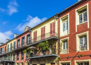
In 1947, Tennessee Williams penned “A Streetcar Named Desire,” effectively immortalizing the public transit line that, from the 1920s, served the rollicking French Quarter as well as the working class Marigny and Bywater neighborhoods, located downriver.
Sadly, the last car to serve the Desire line rattled through town in 1948, a victim of transportation “progress.” It was replaced by a choking diesel bus, which lacked the aesthetic value of the streetcars. Where 235 miles of streetcar tracks once formed a lace across the city’s streets most of the tracks were ultimately paved over, as noxious buses became the standard.
Blessedly, even the Purveyors of Progress could not bear to dismantle the charming St. Charles Avenue streetcar line and its service has remained uninterrupted since its inception in 1893. Spacious olive green 900-class streetcars built by Perley A. Thomas Car Company in 1923-24 still serve the line today. These cultural icons were fully restored and refurbished between 1988 and 1994.
The Historic St. Charles Avenue Line
The St. Charles Avenue Streetcar may very well be the nation’s most pleasant form of public conveyance existing today. The line was named to the National Register of Historic Places in 1973. To maintain this stature, the Regional Transit Authority, which operates New Orleans’ streetcar system, has rejected adding air conditioning and making the streetcars wheelchair accessible. However, the 46 streetcars’ double-hung windows can easily be opened to emit the cooling breezes generated by the moving cars so it’s always a comfortable ride.
For a leisurely exploration of the Central Business District, the Garden District and Uptown, visitors staying in the French Quarter should board the St. Charles Avenue streetcar at the corner of Carondelet and Canal streets (Stop No. 0). Each car stop has a designated number and there are dozens of stops along the line.
The line serves a 6.5-mile run that stretches between Stop No. 0 at the edge of the French Quarter, down St. Charles Avenue to the Riverbend where it turns onto South Carrolton and continues to its terminus at South Carrollton and South Claiborne avenues. The cars turn around at the end of the line and head back in the opposite direction. A one-way trip along the line takes about 45 minutes.
The Riverfront Line
In 1988, when city officials unveiled a new 1.9-mile Riverfront Streetcar Line, they were amazed by the enthusiastic reception it received. What was originally planned as a novelty project to be rolled out in conjunction with that year’s National Republican Convention quickly became a favored means of transportation for both visitors and locals.
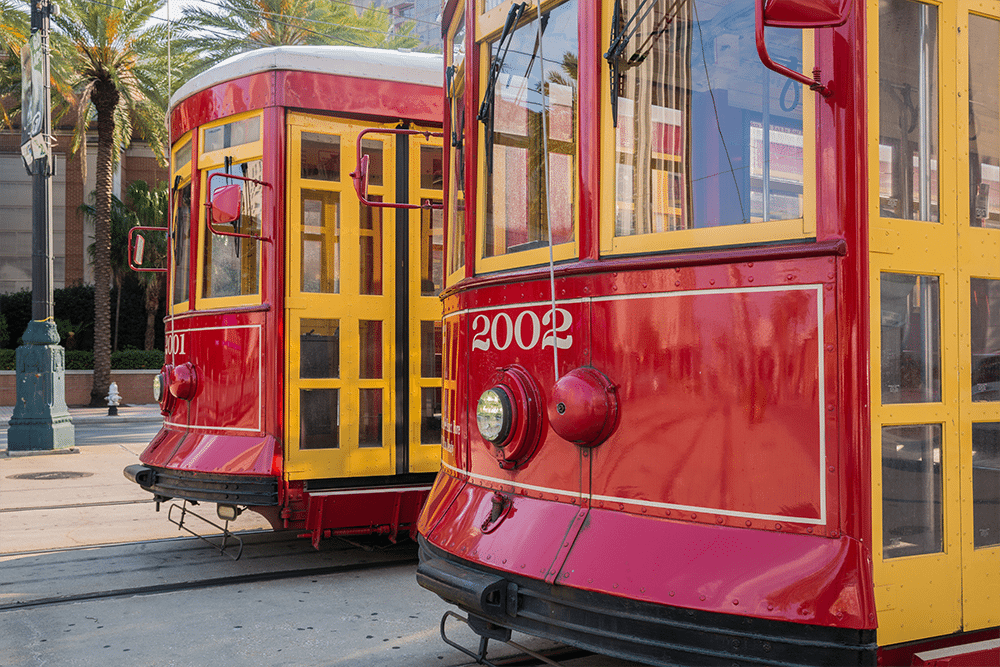
It was the city’s first new streetcar line since 1926 and the Powers That Be quickly determined that with regard to public transit in New Orleans, the old ways were, indeed, the best. Plans to reinvigorate streetcar service throughout key areas of New Orleans were soon underway. Seven bright red streetcars now service the Riverfront line, which includes 10 stops between Esplanade Avenue and the Ernest N. Morial Convention Center.
The one car with its doors located at either end is a vintage Perley A. Thomas’ built in 1923-24, like the St. Charles Avenue cars. The remaining Riverfront cars were built by the RTA in partnership with local vendors and craftsmen. Though they are not air-conditioned, like in the St. Charles Avenue cars, the double-hung windows open to emit the river breeze. All of the cars are wheelchair accessible.
The Canal Street Line
In the spring of 2004, streetcar service was joyously welcomed back to Canal Street after a 40-year absence. The new Canal Streetcar Line tied into the existing Riverfront Streetcar Line from Esplanade Avenue to Canal Street and along Canal Street from the Mississippi River to a streetcar terminal at City Park Avenue and the Cemeteries.
A spur line along North Carrollton Avenue connects Canal Street to City Park at Beauregard Circle, making for easy access to the park and the New Orleans Museum of Art. Streetcars run in the neutral ground on Canal Street for the entire 4.13 miles. Tracks for the one-mile spur on North Carrollton Avenue run in the left traffic lane and terminate at Beauregard Circle opposite the New Orleans Museum of Art.
Like the St. Charles Avenue Line, the Canal Line provides French Quarter visitors with easy access to some of the city’s other unique neighborhoods — in this case, Mid-City and the cemeteries.
The Rampart/St. Claude Line
In 2016, the latest addition to the New Orleans streetcar network opened to the public: the Rampart/St. Claude line. This fully air-conditioned route skirts the edge of the French Quarter along Rampart St. (once the literal walls of the city), running from Canal St. past Armstrong Park and the Treme.
At this stage, Rampart St. splits off and the streetcar follows St. Claude Avenue to its intersection with Elysian Fields Avenue. The line provides access to sites within the Treme like St. Augustine Church, Armstrong Park, and the Backstreet Cultural Museum, and gives visitors a glimpse of the French Quarter that is often missed by many tourists.
Like the Riverfront cars, the 24 cherry red cars that service the Canal Line were locally built under the auspices of the RTA. All of them are air-conditioned and provide wheelchair access. Due to the space needed to accommodate wheelchairs, the Canal and Riverfront cars provide seating for 42 passengers, 18 fewer than the St. Charles Avenue cars.
All three of New Orleans’ streetcar lines provide service 24 hours a day with frequent service during the day and hourly appearances from midnight to 6 a.m. The fare for each is $1.25 per person. Transfers cost $.25. Exact change is required. You can get passes online, too.
We hope this will help you get where you need to go, and happy sightseeing while you are at it!
If you’re planning a stay in New Orleans, be sure to check out our resource for French Quarter Hotels.